What is the new ‘normal’ and how does it align with creating a sustainable future? Join the conversation on Responsible Resilient Recovery at GeoCom21 on 30 November and 1 December.
Over two afternoon sessions, thought-leaders from Government, industry and business will be sharing insights on what Responsible Resilient Recovery means from a global perspective. We’ll also be discussing the environment and sustainability, public health, infrastructure and the economy.
Registration is now open. Not a member of AGI? Join us and sign up for free Network membership and register to attend GeoCom21.
We’re once again holding our flagship event online to enable as many people as possible to participate.
Denise McKenzie (AGI Chair) says “As UK prepares to move forward from this unprecedented moment in history, we will explore the opportunities for geospatial and the role of our community in setting the direction of the new normal and creating a sustainable future. Geospatial has played a vitally important role in our collective response to Covid and can play an even bigger role in our recovery from it. We will consider how to shape a more resilient world while using making responsible use of geospatial technologies.”
The programme covers what Responsible Resilient Recovery means form a global perspective, as well as focusing on themes of; Sustainability, Environment, Public Health, Infrastructure and the Economy. We are looking forward to welcoming you to the GeoCom21.
Follow us on Twitter using #GeoCom21
November 30th
12:30 – Conference Opens (Networking)
13:00 – Welcome – Denise McKenzie – AGI Chair
Global Perspectives
13:05 – Toby Wicks – CEO RE:ACT Disaster Response
How can data be used ethically and responsibly to support humanitarian efforts worldwide?
13:25 – Platinum Sponsor Presentation
Public Health
13:40 – Dr. Este Geraghty, Chief Medical Officer at Esri
Awareness of health GIS applications expanded during the pandemic. How will GIS technology support current stage pandemic response/recovery and future transformation of the health sector?
13:55 – Ian Maxfield – Associate Head of Geographic Intelligence and Mapping- NHS South, Central and West
As an NHS Geospatial team, what have we learnt from the pandemic that will take us forward through the recovery and beyond?
14:10 – Panel Session Q&A
14:30 – Break and Open House
Economy
14:45 – Ben Scott-Robinson, Co-founder & CEO of the Small Robot Company
Farming is facing growing and existential challenges to deliver sustainable, secure and resilient food production in the UK. How can the commercial sector respond to these challenges?
15:00 – Karina Grosheva, Co-founder, SDX Space
How can alternative geospatial data stimulate responsible investment in energy and resource sectors in Global South for the EU and UK?
15:15 – Panel Session Q&A
15:35 – Closing Remarks – Denise McKenzie – AGI Chair
15:40 – Networking
16:30 – Close
December 1st
12:30 – Conference Opens (Networking)
13:00 – Welcome – Denise McKenzie – AGI Chair
Global Perspectives
13:05 – Cathrine Armour – Chief Customer Officer UKHO
During the Decade of the Ocean, how can we ensure that the power of geospatial data is harnessed to address the most significant challenges the planet is yet to face?
13:25 – Platinum Sponsor Presentation
Environment
13:40 – Professor Jane Rickson – Professor of Soil Erosion and Conservation, Cranfield Soil and Agrifood Institute
Data about soils can be related to most, if not all, of the UN’s Sustainable Development Goals. How can geospatial approaches be used to help sustain this most precious resource?
13:55 – Rufus Howard – Policy Lead for Impact Assessment, IEMA
Geospatial and digital techniques are evolving rapidly. How are they supporting the field of environmental and social impact assessment?
14:10 – Panel Session
14:30 – Break and Open House
Infrastructure
14:45 – Sarah Chilcott – Managing Director at PortalPlanQuest Ltd
What role can land and property data can play in transforming the planning and construction process? Where do the challenges and opportunities lie?
15:00 – Ed Parham, Architect and Director of Innovation and Design, Space Syntax
Spatial analytics can show how the built environment affects long-term social and economic outcomes. How can these insights be used to inform planning and design decisions?
15:15 – Panel Session
15:35 – Closing remarks – Denise McKenzie – AGI Chair
15:40 – Networking
15:40 – Early Careers Network Event
16:30 – Close
*Schedule may be subject to change before the event
GeoCom21 confirmed speakers
Toby Wicks, CEO RE:ACT Disaster Response

Toby is a geographer and humanitarian. His career has focused on introducing and applying innovations in data and technology to some of the world’s biggest challenges. He is currently leading a transformational change programme as the Chief of Data and Analytics at UNICEF. Prior to his current role, Toby led the Management Information team at the Department for International Development and in previous regional humanitarian roles at UNICEF, he managed responses in the Central African Republic, Cameroon, Chad, Libya, and Yemen. Toby’s early career was focused on geospatial data, including roles with the World Health Organisation, Ordnance Survey, and as a volunteer and board member with the NGO MapAction. He holds a PhD in remote sensing and an MBA from INSEAD.
Dr. Este Geraghty, Chief Medical Officer at Esri

Dr. Este Geraghty, MD, MS, MPH, CPH, GISP, is the Chief Medical Officer at Esri where she leads strategy and messaging for the Health and Human Services sector. Dr. Geraghty has been with Esri since 2014 and has led business development and solution development in the market. During her time at Esri, Dr. Geraghty has helped organizations around the world use location intelligence to combat Zika virus, finish the fight against polio, grapple with the opioid crisis, combat homelessness, enhance health preparedness and response, inform strategic planning, optimize healthcare access, and traverse the COVID-19 pandemic while tackling inequity.
Formerly the Deputy Director of the Center for Health Statistics and Informatics with the California Department of Public Health, Dr. Geraghty led the state vital records and public health informatics programs. There she engaged in statewide initiatives in meaningful use, health information exchange, open data and interoperability. While serving as an Associate Professor of Clinical Internal Medicine at the University of California at Davis she conducted research on geographic approaches to influencing health policy and advancing community development programs. In addition to her degrees in Medicine, Medical Informatics and Public Health, Dr. Geraghty is also a board-certified public health professional (CPH) and a Geographic Information Systems Professional (GISP).
Ben Scott-Robinson, Co-founder and CEO of the Small Robot Company

Ben co-founded the Small Robot Company in 2017 with a vision to transform food production with accurate, smart, lightweight robots. He is an accomplished digital entrepreneur focused on geospatial and mobility technologies with a background in user experience design. He worked on the digital transformation of the Ordnance Survey maps, including shaping the technology behind the autonomous vehicles soon to become commonplace on roads. Ben is an early mobile technology innovator, in his time founding two agencies, two consultancies, an app startup and a phone for blind people. He was in the Drum Magazine’s Mobile Top 50 for two years running, in the Digerati Top 100 and won Experience Innovator of the Year.
Ian Maxfield, Associate Head of Geographic Intelligence and Mapping, NHS South, Central and West
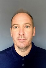
Ian is a Geographer with over 18 years’ experience working in the geospatial industry. He is Associate Head of Geographic Intelligence for NHS South, Central and West Commissioning Support Unit – a role he is proud of, using GIS to support the NHS and improve the health of the general public. He also has extensive experience of GIS within the Renewable Sector as well as with Local Government. Moreover he has lectured at a number of universities, in addition to a previous life as a secondary school Geography teacher. He has a general passion for all things geospatial, with a particular focus on the development of GIS as a career for students.
Karina Grosheva, Co-founder, SDX Space

Karina Grosheva is an impact tech innovator and sustainable data expert. She brings expertise in designing innovative data products to complex challenges posed by targets on sustainable development and humanitarian response. Karina is former CEO of Taqadam – startup on geospatial data processing and serves as CTO for SDX space. Karina spent 8 years in the UN, designing data solutions, and in-country innovations, and before that worked in management consulting for digital transformation using AI and Big data innovation.
Cathrine Armour, Chief Customer Officer at the UK Hydrographic Office (UKHO)
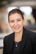
Cathrine is responsible for the development of marine data solutions that support safe, secure and thriving oceans. With expertise from research and innovation, to product development, global sales and marketing Cathrine’s teams deliver a range of leading products, services and programmes that are helping to stimulate blue economic growth by unlocking access to marine geospatial data. This includes working in partnership with maritime organisations globally, to deliver a range of world-leading navigational products that are found on board over 90% of ships trading internationally.
Cathrine joined the UKHO having led innovative projects that have not only utilised geospatial data to generate economic growth, but also create significant positive change. This includes Ordnance Survey’s award-winning ‘Geovation’ Accelerator and Hub, and leading the international Eye on Earth programme to improve global cooperation addressing the availability, accessibility and usability of environmental data for sustainable development.
Dr Jane Rickson, Professor of Soil Erosion and Conservation, Cranfield Soil and AgriFood Institute
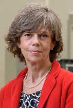
Jane Rickson is Professor of Soil Erosion and Conservation at Cranfield University. Trained as a physical geographer and geomorphologist, she has over 35 years’ experience of research, consultancy and teaching in sustainable land management in the UK and abroad. Her work applies the geospatial information in Cranfield University’s national soil map and land information system (LandIS) to address sustainability issues, in particular how soils data relates to most of the UN’s Sustainable Development Goals, including food security, climate change mitigation and protection of natural capital. She works with farmers, land-based charities, and Government to find cost effective, practical solutions for sustainable land resource management. She is past President of the Institution of Agricultural Engineers, a Chartered Environmentalist and a member of the Institute of Professional Soil Scientists. In 2020, Jane was awarded the Sydney Andrew Medal for encouraging the application of science for public benefit. In 2021, Jane was named as one of the top 50 Women in Engineering by the Women’s Engineering Society.
Sarah Chilcott, Managing Director at PortalPlanQuest Ltd
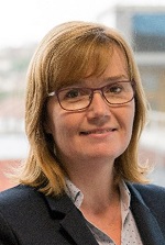
Sarah Chilcott is Managing Director at the national Planning Portal, where she has spent the last 12 years. Prior to that she worked in and with various science and technology businesses, as well as spending some time working in the public sector.
Planning Portal supports the planning and development process by providing information, guidance and services for homeowners, professionals and local authorities across England and Wales. It receives approximately 1 million visits every month and processes around 2,200 planning applications each working day.
Planning Portal is a joint venture between data and technology company TerraQuest Solutions and MHCLG. Its mission is to transform planning and building and it is at the forefront of driving forward the digitalisation of the planning process.
Ed Parham, BA(hons) DipArch RIBA, Director
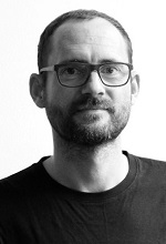
Ed is an Architect and Director of Innovation and Design at Space Syntax.
These roles combine the development of tools to analyse cities with their application to real-world design and planning projects. The overarching objective behind these activities is to create better cities for people by understanding the interactions between urban systems.
In his time at Space Syntax he has led international multi-disciplinary design teams to masterplan capital cities, improve health outcomes in UK cities and shape the development of digital tools that enable untrained users to make evidence-informed decisions.
Rufus Howard, Policy Lead for Impact Assessment, IEMA

Dr Howard is the IEMA Policy Lead for Impact Assessment, an Environmental and Social Expert at the International Finance Corporation, and the Managing Director of Greenfriars sustainability consultancy. A leading professional focusing on sustainable development, Rufus specialises in providing strategic advice for public, private and NGO clients across the UK and internationally.
A trusted advisor, Rufus is a Fellow of IEMA, a Chartered Environmentalist and has over two decades experience across major renewable energy and infrastructure projects. Over his career, Rufus has led high profile projects for clients such as the World Bank, The Crown Estate, National Grid and the Environment Agency.
Bookings
Bookings are closed for this event, please contact AGI Support on info@agi.org.uk

